QUILOTOA INFORMATION


Information about Activities and Sports in Quilotoa at the Ilinizas Reserve.


QUILOTOA PHOTOGRAPHY


Enjoy the Quilotoa's Landscapes at the viewpoints around the crater


Quilotoa Viewpoint

Viewpoint "Lagoon Quilotoa"

  • Altitude: 3996 m.s.n.m.

MAP VIEWPOINT LAGUNA DEL QUILOTOA


Viewpoint "Torre Quilotoa"

  • Altitude: 3950 m.s.n.m.

MAP VIEWPOINT TORRE DEL QUILOTOA

Viewpoint "Shalala Quilotoa"

  • Altitude: 3900 m.s.n.m.

MAP VIEWPOINT SHALALÁ


Viewpoint "Monte Juyende"

  • Altitude: 3930 m.s.n.m.

MAP VIEWPOINT MONTE JUYENDE


ACTIVITIES

QUILOTOA TREK


Explore the extraordinary Quilotoa Trails


Quilotoa Crater Complete Trail

This trail is a full loop around the Quilotoa crater. One of the most challenging hikes to try at the Quilotoa Volcano.

  • Altitudinal Range: 3.739m ↔ 3.929m
  • Distance: 11km
  • Duration: 4-6hours

MAP - QUILOTOA CRATER LOOP TREK


ACTIVITIES

Sendero Quilotoa

Quilotoa Lagoon Trail (La Playita Quilotoa)

This trail is the way to the shore of Quilotoa Lagoon. This area's is called "La Playita Quilotoa" which mean "Quilotoa's Beach".

  • Altitudinal Range: 3.523m ↔ 3.870m
  • Distance: 3.3km
  • Duration: 2-3hours

MAP - QUILOTOA LAGOON TRAIL


ACTIVITIES > QUILOTOA BEACH GUIDE

Sendero Laguna Quilotoa

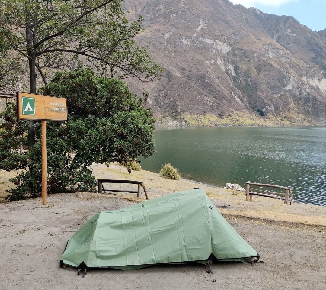
QUILOTOA CAMPING


The Adventure of Camping on a Volcanic Lake in the Andes Mountains


Camping in Quilotoa

At the shores of Quilotoa Lagoon there is an area for Camping. This zone is called "La Playita Quilotoa" which mean "Quilotoa's Beach". To get there you must do a trail to the Playita del Quilotoa ( "Quilotoa Lagoon Trail").

  • Altitude: 3730m.s.n.m.
  • Temperature: -3°C ↔ 18°C (25°F ↔ 64° F)
  • No reservation needed.
  • Registration at entrance is required.

QUILOTOA CAMPING MAP


ACTIVITIES > QUILOTOA CAMPING GUIDE

Camping Quilotoa

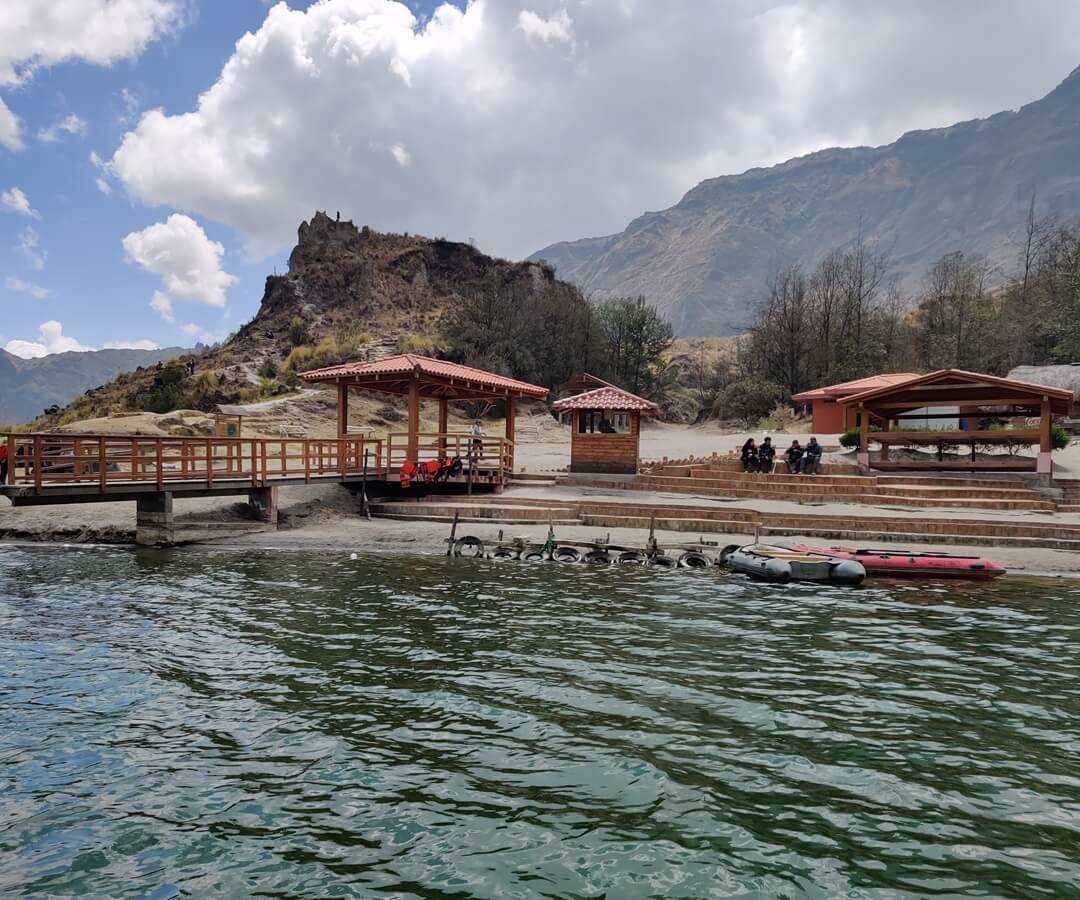
SAIL QUILOTOA LAGOON


Venture out on a boat or kayak ride through the Quilotoa Lake


Boat Trip across the Quilotoa Lagoon

On the shores of lake Quilotoa (called "La Playita Quilotoa") you can rent a boat or kayak to navigate the waters of Quilotoa Lagoon.

  • Altitude: 3730 meters above sea level
  • Lake Surface: 307hectares
  • No reservation needed.
  • Tickets are sale on place.

ACTIVITIES > QUILOTOA BEACH GUIDE

Navigate Quilotoa

QUILOTOA CYCLING


Cycle the challenging paths surrounding the Quilotoa


Quilotoa Bicycle Trails

You have the option of cycling along the Panamericana Sur Highway from Quito or Latacunga to the Sigchos or Zumbahua detours and proceed towards Quilotoa.

MTB trails are avaible around Quilotoa. This routes are organized by specialized agencies or following a Trans-Ecuador MTB route.

  • Highway Zumbahua: Paved
  • Highway Sigchos: Paved / Gravel
  • MTB Road: Ballast / Gravel

Bike Tour Quilotoa > Cotopaxi > Chimborazo


ACTIVITIES

Quilotoa Cycling

Quilotoa Videos


Influencers, Tourists and Adventurers who visited the Quilotoa Lagoon


¡ÚNETE HOY!

⭐️ Ofertas, Promos y Eventos para tu viaje por Ecuador...